ESA and Testnor partner to expand access to real-world GNSS interference data

Publication date

03 Nov 2026

The European Space Agency (ESA) has signed a contract with Norwegian company Testnor for the development of a library of GNSS interference recordings and radiofrequency (RF) playbacks for industry use. The project follows a call for projects by the Norwegian Space Agency to support the development of resilient positioning, navigation and timing (PNT) solutions. 

Funded through ESA’s Navigation Innovation and Support Programme (NAVISP), the service will be built on GNSS interference recordings, starting with data collected at Jammertest, the Norwegian government’s annual open-air GNSS interference exercise coordinated by Testnor and recognised as the world’s largest event of its kind. 

As demand grows for resilient PNT technologies, access to authentic interference data is becoming increasingly important for companies developing GNSS receivers, chipsets, anti-jam and anti-spoofing antennas, as well as critical infrastructure operators and system integrators. 

Yet access to real-world interference environments remains tightly regulated, limiting opportunities for testing under representative conditions. 

To address this gap, Testnor will create a curated online Signal Data Library. Customers worldwide will be able to license authentic multi-constellation GNSS interference recordings and access a laboratory RF replay service. This will allow them to perform realistic tests to assess the vulnerabilities of their technologies, validate performance and strengthen overall resilience. 

Over the next two years, the Tromsø-based company will mature the service to Technology Readiness Level 9 (TRL 9) with the aim of delivering a fully operational commercial offering for the global Positioning, Navigation and Timing (PNT) market. 

“Testnor has already proven its value by contributing to the development of Jammertest, one of Norway’s most important contributions to GNSS resilience. Through NAVISP, we are helping Testnor transform that experience into a market-ready service that will make authentic interference data accessible to industry,” says Rafael Lucas Rodriguez, Head of NAVISP at ESA. 

“We are scaling our services and building the capacity Europe needs, with the support of the European Space Agency’s NAVISP programme. This makes realistic testing available to the entire GNSS industry, so they can build and validate resilient products,” says Ingrid Dahl Skarstein, Chief Operating Officer and co-founder of Testnor.
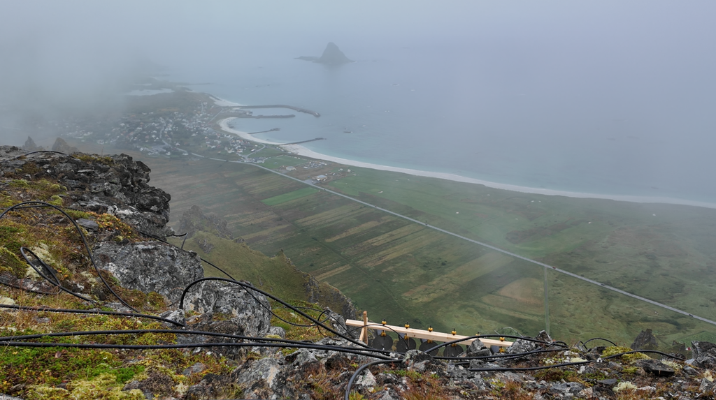
Jammertest in Bleik. Image credit: ESA

ESA chooses Norse Navigation for resilient maritime positioning

Publication date

02 Nov 2026

The European Space Agency (ESA) has signed a contract with Norwegian company Norse Navigation to develop maritime positioning sensors capable of maintaining trusted performance in the presence of GNSS interference. 

The project follows a call for projects by the Norwegian Space Agency to support the development of resilient positioning, navigation and timing (PNT) solutions. The activity is funded through ESA’s Navigation Innovation and Support Programme (NAVISP). 

The 17-month project will help the Trondheim-based company to further mature its sensor technology to Technology Readiness Level 8 (TRL 8), taking the products through maritime certification testing and customer validation. 

Designed for SOLAS (Safety of Life at Sea)-compliant merchant vessels and professional maritime users, the solutions aim to enhance navigational safety, confidence and resilience in increasingly contested operational environments where jamming and spoofing incidents can be a daily occurrence. 

As part of the development, Norse Navigation will integrate the latest multi-constellation GNSS capabilities, Galileo Open Service Navigation Message Authentication (OSNMA) technology, advanced jamming and spoofing detection, controlled degraded-mode operation and bridge-compatible alert mechanisms. 

The products will be fully compatible with existing maritime navigation infrastructure, such as radar, integrated navigation systems, automatic identification systems (AIS) and electronic chart display and information systems (ECDIS). 

“Demand for resilient PNT solutions is growing across the maritime sector, from commercial shipping operators to port authorities and infrastructure managers. By supporting Norse Navigation through NAVISP, ESA is helping accelerate the availability of market-ready technologies that can maintain trusted navigation services even in GNSS-challenged environments,” says Rafael Lucas Rodriguez, Head of NAVISP at ESA. 

“Europe has built world-class protection for satellite navigation through Galileo and EGNOS. With ESA’s support, we are turning that capability into certified, affordable sensors for commercial ships. They do more than raise an alarm. They detect jamming and spoofing, counter the attack, and keep a position the crew can trust,” says Thomas Lund, Norse Navigation Chief Operating Officer and co-founder. 

ESA selects Rift Dynamics for interference-proof drone navigation

Publication date

01 Nov 2026

The European Space Agency (ESA) has signed a contract with Norway’s Rift Dynamics to develop a resilient Positioning, Navigation and Timing (PNT) solution for low-cost expendable unmanned aerial vehicles (UAVs) operating in GNSS-challenged environments. The project follows a call for projects by the Norwegian Space Agency to support the development of resilient PNT solutions. 

Funded through ESA’s Navigation Innovation and Support Programme (NAVISP), the project will support the Sandnes-based company in maturing its solution to Technology Readiness Level 7 (TRL 7) through a series of jamming, spoofing and Arctic trials. 

The solution aims to provide up to 10 minutes of reliable operation in GNSS-denied conditions while maintaining bounded positioning drift and rapid reconvergence once GNSS signals become available again. Designed for integration into low-cost UAV platforms, it seeks to make resilient navigation affordable for large-scale fleet deployment. 

Building on an architecture combining GNSS and Inertial Navigation System (INS) sensors with integrity monitoring, the system will integrate complementary navigation aids including low-light optical sensors, terrain-matching techniques and radio-based ranging capabilities. The project will also assess the benefits of Controlled Reception Pattern Antenna (CRPA) technology to further enhance resilience against interference. 

“Over the past few years, the drone sector has been expanding rapidly, with operational services emerging across defence, transport, public safety and infrastructure operations. Through this project, we are helping establish the foundations for resilient UAV navigation technologies that can support the continued growth and adoption of drone services across Europe,” says Rafael Lucas Rodriguez, Head of NAVISP at ESA.